Web Mapping Applications
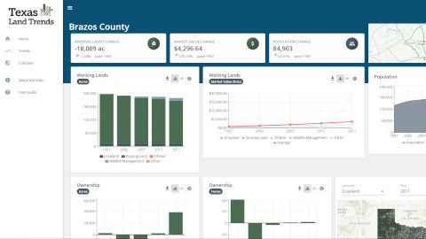
Land Trends Data Explorer
The Land Trends data explorer allows users to explore working land trends for Texas from 1997-2017.
View Dashboard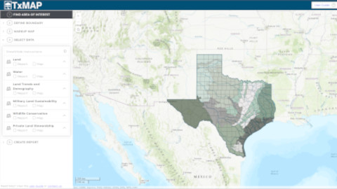
TxMAP
TxMAP allows users to customize a map by defining areas of interest to perform an intersect on selected layers. Results can be printed directly, or exported as an informative report.
View Web App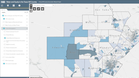
Water in the Texas Hill Country
The Texas Hill Country Conservation Network needed an assessment of water challenges and their impact on Hill Country communities. This tool provides a baseline of where issues intersect with water challenges in the Texas Hill Country.
View Web App
Texas Compatible Use Zones Viewer
Texas Compatible Use Zones Viewer tool identifies if a user's location of interest may pose land use compatibility concerns with DOD operations, using data from DOD's compatible land use planning programs.
View Web App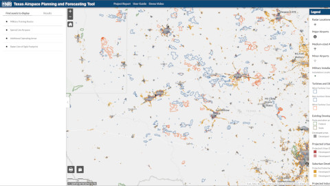
Texas Airspace Planning and Forecasting Tool
Texas Airspace Planning and Forecasting Tool provides Texas military installations with an interactive way to visualize future land use change that may have adverse implications on military test and training spaces, especially aviation assets.
View Web App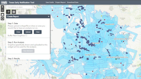
Texas Early Notification Tool
Texas Early Notification Tool (TENT) is a tool built for wind energy professionals that allows for strategically planning future wind energy development.
View Web App